Glorious Utah, through Escalante on Highway 12
We travelled through the small town of Escalante itself, another Mormon settlement, and then we were driving through the wilderness area of Escalante National Monument. Again there were overlooks to see across vast distances, mainly at the head of dirt roads which lead into the interior of the Park. The first of these was at the beginning of the 57 mile long Hole-in-the-Rock Trail, which follows the route taken by Mormon pioneers in 1879-80 to find a route across to the Colorado River. They managed to find the only gap in the otherwise impenetrable 400m cliffs that fringe Glen Canyon, and it took them 6 weeks to forge a route across using picks shovels and explosives. Finally they had to lower their wagons and animals off from the cliff using block and tackle before building a raft to cross the river.
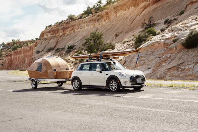
We saw a rather lovely wooden caravan here, obviously made to match the canoe.
We saw a rather lovely wooden caravan here, obviously made to match the canoe.
Then it was short hop to the Head of the Rocks overlook, where we looked across the expanse of the Escalante terrain. This was the last bit of Highway 12 to be metalled and the job, undertaken between 1935-1940, was so difficult and laborious it was nicknamed the "Million Dollar Highway".
The scenery cried out for a panorama to be taken.
Next stop was the Boynton Overlook, which is a more fertile area next to the Escalante River. This is a great habitat for the local wildlife, including river otters.
We did not have time to walk down to the river, but we had to stop at the Kiva Coffee House, which stands next to the road at this point. They were just about to close but served us with coffee, and a cake too, from this remarkable eco friendly building.


Comments
Post a Comment