Posts

Showing posts from July, 2018

Glorious Utah, through Escalante on Highway 12
Image
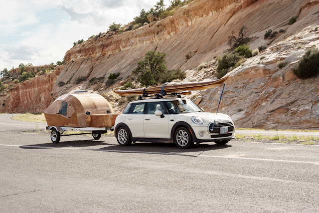
We travelled through the small town of Escalante itself, another Mormon settlement,  and then we were driving through the wilderness area of Escalante National Monument. Again there were overlooks to see across vast distances, mainly at the head of dirt roads which lead into the interior of the Park.  The first of these was at the beginning of the 57 mile long Hole-in-the-Rock Trail, which follows the route taken by Mormon pioneers in 1879-80 to find a route across to the Colorado River. They managed to find the only gap in the otherwise impenetrable 400m cliffs that fringe Glen Canyon, and it took them 6 weeks to forge a route across using picks shovels and explosives. Finally they had to lower their wagons and animals  off from the cliff using block and tackle before building a raft to cross the river. We saw a rather lovely wooden caravan here, obviously made to match the canoe. Then it was short hop to the Head of the Rocks overlook, where we looked across the expanse of t

Glorious Utah, Highway 12 a great road trip

Image
We had some lunch after we had finished our walk and then set out on the next stage of the trip. We were taking Highway 12 out of Bryce and then north through the edge of Escalante National Monument, final destination Capitol Reef. This road was carved by the Mormons who made their settlements along it's route. They kept animals,  and grew crops, forging a living from the hard stony soil along the way. Map courtesy of the Scenic Byway 12 Foundation The soil changed colour from red to white and became thin. We were at the edge of the Kaiparowits Plateau which extends nearly to the border with Arizona and the Colorado River. By Henrieville we stopped to look at an impressive mesa set in former fields that had been so hopelessly overgrazed by thousands of sheep, that they were left barren. The Taylor Grazing Act was signed by Franklin D Roosevelt in 1934, during the Great Depression, to license and restrict the amount of grazing in order to stop land erosion. In fact only

Glorious Utah, walking the hoodoos

Image
Inspired by the thought of walking around the hoodoos, we resolved to do the Navajo Loop Trail which runs on the floor of the Canyon between Sunset and Sunrise Points. I had already done this with Mike, but the weather on this day was different, and there is so much to capture anyway. You descend from Sunset Point down a steep path known as Wall Street, for obvious reasons. At the bottom of Wall Street are some tall Douglas firs which are beginning to grow higher than the hoodoos. Going down you get a good view of Thor's Hammer a well known landmark. The whole of the floor of the canyon seems to glow red from the light reflected from the rock and the floor of the Canyon. It was a great walk and I took far too many pictures, but what's new! Thor's Hammer 2 rock arches Twisted trunk of a limber pine Pinyon jay Limber pine Aster