Posts

Showing posts from April, 2015

California, 10th November, Lime Kiln State Park

Image
We had our usual late lunch and the time was getting on. On our way north we saw a signpost to Limekiln State Park, so we thought that this would be something a little different to all the coastal stuff we had done recently. It was still overcast, and once we had got into the wooded paths of the park, a little depressing. We trundled along through the mud and spent pine needles to a small waterfall. The guide book said it should be a 'magnificent 100ft-high waterfall' but in these days of drought the fall was reduced to a trickle. We then went to see the limekilns themselves, built to manufacture lime from limestone for the cement industry. Buildings from Monterey to San Francisco were raised using lime created in these woods. An unfortunate consequence of the kilns is that all the old trees were chopped down to fuel them. It was getting quite late when we left the park and so we went straight to our booked place at Pfeiffer Big Sur State Park, bypassing a couple of key sites...

California, 10th November, sand patterns on Jade Cove

Image
Jade Cove is reputed to have patches of purple sand and while looking for them I became fascinated by the different patterns the tide had left on the sand. We eventually did find some purple streaks. Here are the results! And then with additions  

California, 10th November, Big Sur, Jade Cove

Image
Following Highway 1 north we arrived at Jade Cove. Off shore there are many small islands, whitened by guano and the way on to the beach is down a steep wooden staircase. Jade can be found on the beach, especially after storms and some of the rocks are serpentine and a beautiful green colour. There were some dogs running and chasing on the beach, which was very quiet. The weather remained overcast, cool and misty. I think this is normal for this area, even in the height of summer. Here are some more views of the beach

California, 10th November, Ragged Point Inn and a few birds

Image
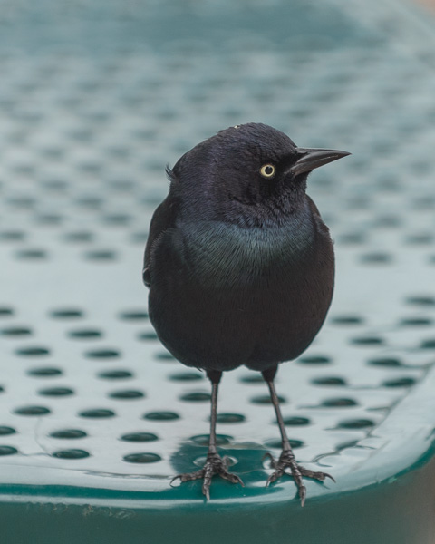
We continued our journey north on Highway 1, along the Big Sur. The mist lying over the water had not really lifted and the ocean still looked wild. Lacking in caffeine, we stopped at the Ragged Point Inn for coffee and a look at the view of the rocky headlands. There were a number of birds looking for crumbs, common birds in the US but fascinating for me. The Brewer's blackbird has beautiful iridescent plumage although his mate is a duller brown. Here are some pictures of this bird taken at the inn and further up the road. We also saw red-winged blackbirds. The male has red and yellow shoulders although in the autumn the colour is reduced. The female is again brown. There was a Monarch butterfly flapping its way around the garden area at the back of the inn. At this time of the year they gather together in huge numbers as they migrate south. Monterey is an area they go to, can't say as I blame them. Finally a cheeky herring gull. All th...

France, 20th-22nd April, driving north

Image
In contrast to the previous days the morning broke to a blue sky, a sure sign that we were leaving Vercors! Alan wanted to cycle up the Combe Laval, retracing the tortuous route we had done the day before, so I packed everything away in the van while he expended some energy. We drove north, stopping off in the town of Villefranche to take Hettie to the vet for the worm medication and check up she needed for her pet passport. Villefranche is not exactly a tourist destination and we were only charged €7 for the privilege compared to the €60 we have had to spend before. We finally stopped in a small place called Chagny, just south of Beaune and we spent a little time in the town, having a beer as the sun went down. The next morning we drove through manicured vineyards, and then further north towards St Omer.   Now we were not far from Calais, but we wanted to see the bunker at La Coupole, sister to the one in Éperlecques which we had visited ...

France, into the Vercors, 19th April, a solitary cave and a misty road

Image
We had lunch in the car park at the memorial and then set out to explore some more.  On the side of the road there was a direction arrow to a cave, the Grotte du Brudour, not a big commercial affair but just a hole in the cliff, so we stopped to investigate. By now it was raining pretty heavily so we put on our waterproofs and walked up the side of the stream until we came to the cave entrance. Alan explored inside but it was very dark with pools of water underfoot and our torch did not penetrate far. Finally we drove the Combe Laval, the heroic road that had first drawn us to the Vercors. This starts from a col known as the Col de la Machine and runs north to St Jean-en-Royans. The weather had really closed in and at first the visibility was non-existent, which added somewhat to the suspense of driving along this vertiginous passage, suspended nearly a thousand feet above the valley floor. But the mist did descend a little allowing me to take a picture of the clas...